Tuesday, May 29, 2007
Google Maps Street View and Mapplets
The previous rumors are coming true: announced at today’s Where 2.0 conference, Google has added a feature called “Street View” in certain locations on Google Maps. Also, Google is adding developer-created gadgets callled “Mapplets” to Google Maps starting today.
Street View
“Street View” displays an interactive panorama photo for certain locations on Google Maps. Note to get this to work outside the US, you need to add “&gl=us” at the end of the search URL. Below are screenshots for a search for 94111 (that’s San Francisco). Camera icons and blue lines indicate the availability of Street View data.
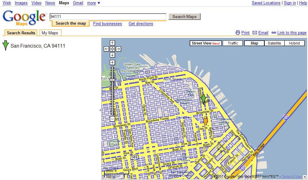
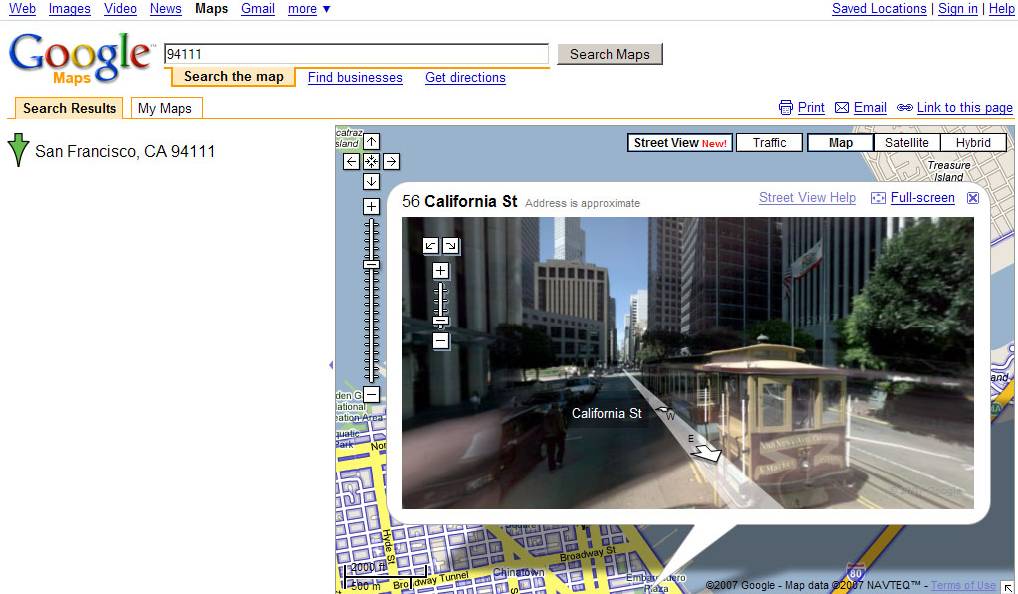
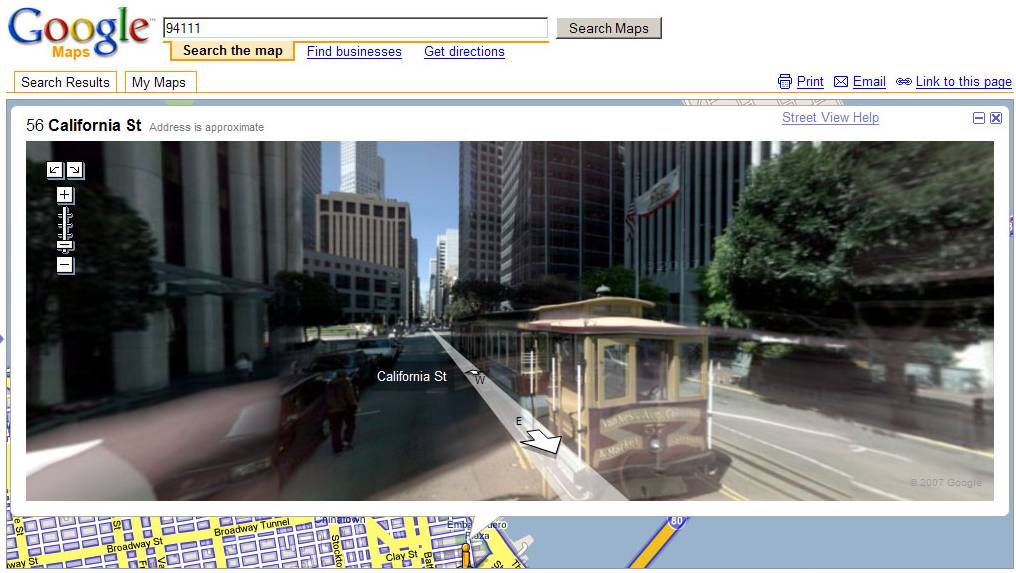
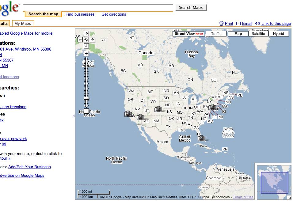
This new view is available for some regions (Silicon Valley, Las Vegas, Miami, Denver and New York, according to Colin Colehour from the US, who says the Street View button disappears when you move the map away from North America), and is an alternative to the existing Traffic, Map, Satellite and Hybrid views. Clicking it you will see a photograph of the location as if you were standing on the streeet looking around. The O’Reilly Radar blog, who says the data for these pictures is coming from Immersive Media (except for San Francisco, which also has a better zoom level, as it turns out), comments, “This is not just a static, A9-style image. It will also let you move along the street in a smooth manner and even more amazing it will let you change your angle and continue moving that way.”
Here’s a video grab showing Street View in action – this looks & feels amazing, albeit there’s potential privacy issues due to the level of detail (you can make out individual faces, license plates and so on):
[Also see the video as WMV.]
The Google help blurb on the Street View feature, displayed at Search Engine Land, explains how the navigation works:
- “Blue outlines show roads where street view is available.”
- “[A person icon on a green arrow] shows where you are on the map. The green arrow points in the direction you’re looking. You can drag the icon to navigate to a different location. You can also just click on a blue outlined road to go there.”
- “Drag the street view to look around 360°. Use the arrow buttons to navigate down the street. You can also use the arrow keys on the keyboad.”
Google in a press release adds that Street View data “will soon expand to other metropolitan areas.” The world is shrinking.
Mapplets
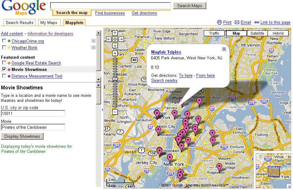
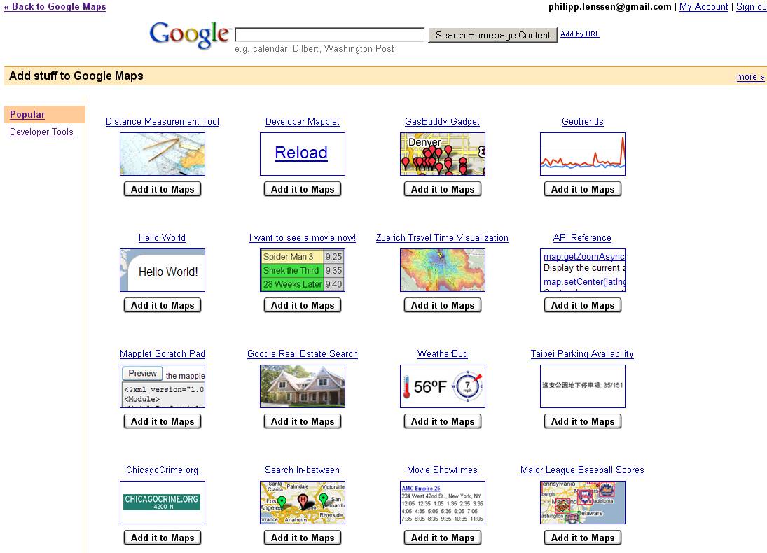
Also today at the Where 2.0 conference, Google announced Mapplets (as in “map applets”). A Mapplet is a special flavor of a Google Gadget, the XML/JavaScript-based widgets you can add to iGoogle – only that this time, you’ll be adding it to Google Maps. From a press release by Google:
Mapplets enables third party developers to create mini applications that can be displayed on Google Maps, much like Google Gadgets are displayed on iGoogle. These Mapplets contain a variety of information, from housing listings to crime data, and tools like distance measurement. Users can select from a wide range of Google and third party Mapplets to display on the Map, essentially creating their own “mashup of mashups” directly on the Google Maps site, while still enjoying the built-in functionality of Google Maps, such as local search and driving directions. A number of our partners, including WeatherBug, Booking.com and Platial have already created Mapplets.
You can take a first look at this feature at a special preview page. Mapplets can be found in the Mapplets directory, and a developer documentation is available as well, clarifying that “Mapplets are mini-webpages that are served inside an IFrame within the Google Maps site. You can put anything inside this mini-webpage that you can put into a normal webpage, including HTML, Javascript, and Flash. Google provides a Javascript API that gives the Mapplet access to services such as manipulating the map, fetching remote content, and storing user preferences.” Google goes on to say that when a Mapplet is enabled by the user, Google will grab a copy of the source from your server to then serve it from gmodules.com (the domain currently caching iGoogle Gadgets as well).
[Thanks Anders C.R., Colin Colehour, TomHTML, Megan Q. and Daniel Garcia!]
[Note that I’ve constantly updated and edited this post as more information came in.]
>> More posts
Advertisement
This site unofficially covers Google™ and more with some rights reserved. Join our forum!